

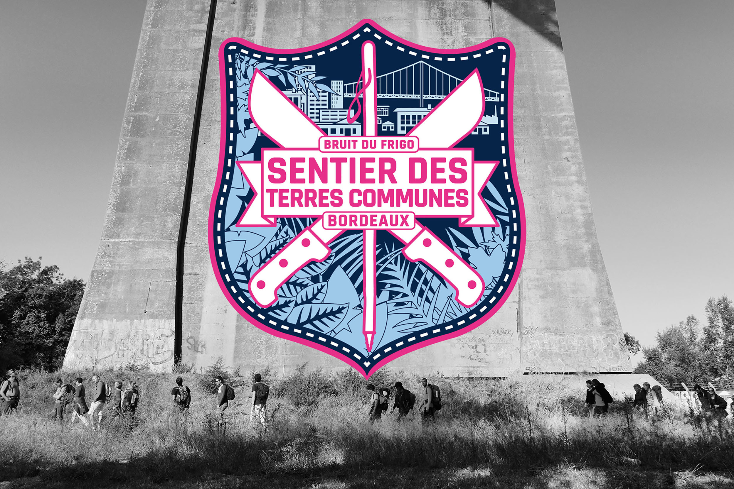
The Common Lands Trail
300 km of routes • 15 one-day loops • 1 large loop of 170 km
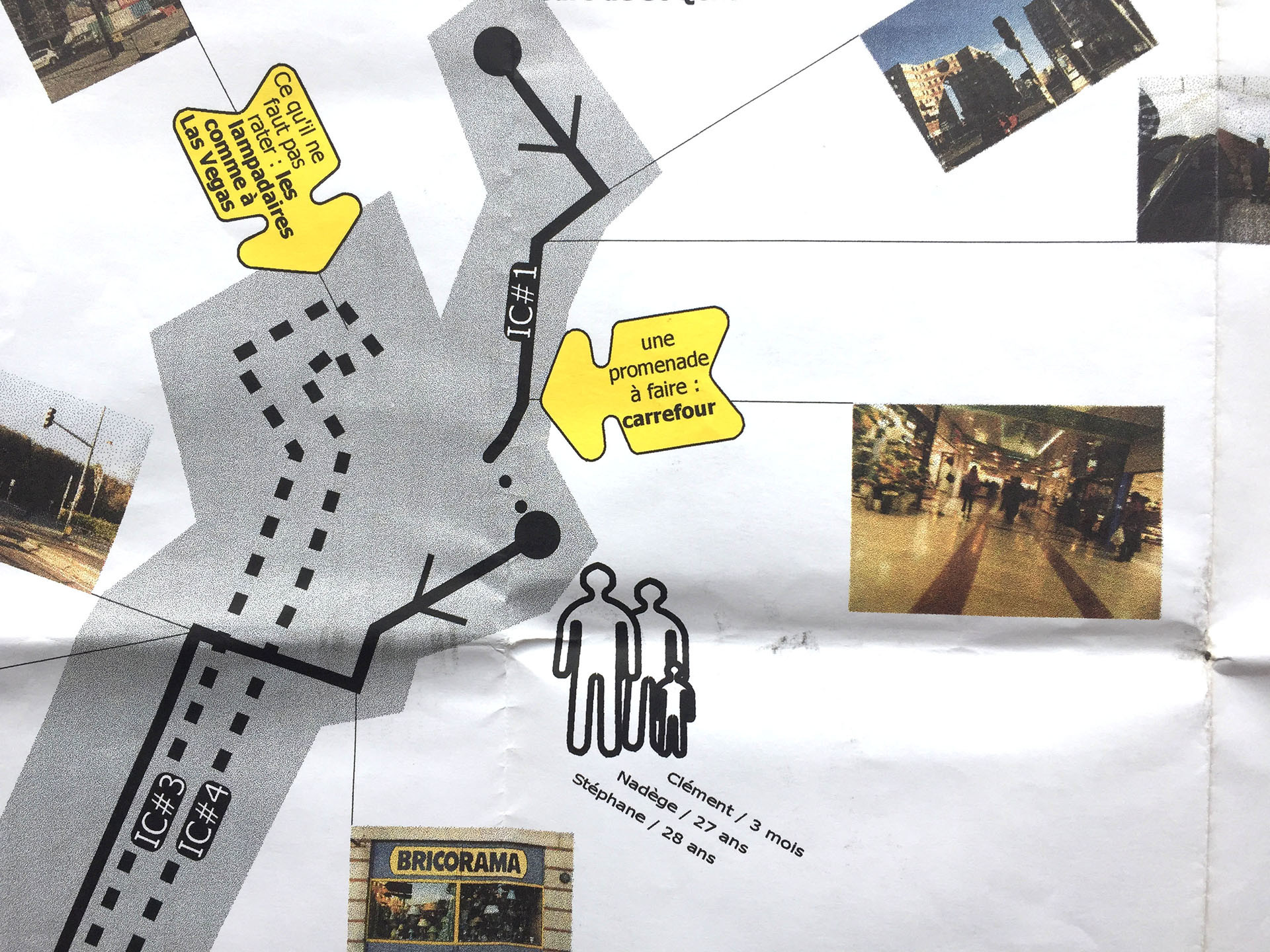
The Common Lands Trail, imagined by Bruit du frigo, offers 300 km of hiking paths through the Bordeaux suburbs.
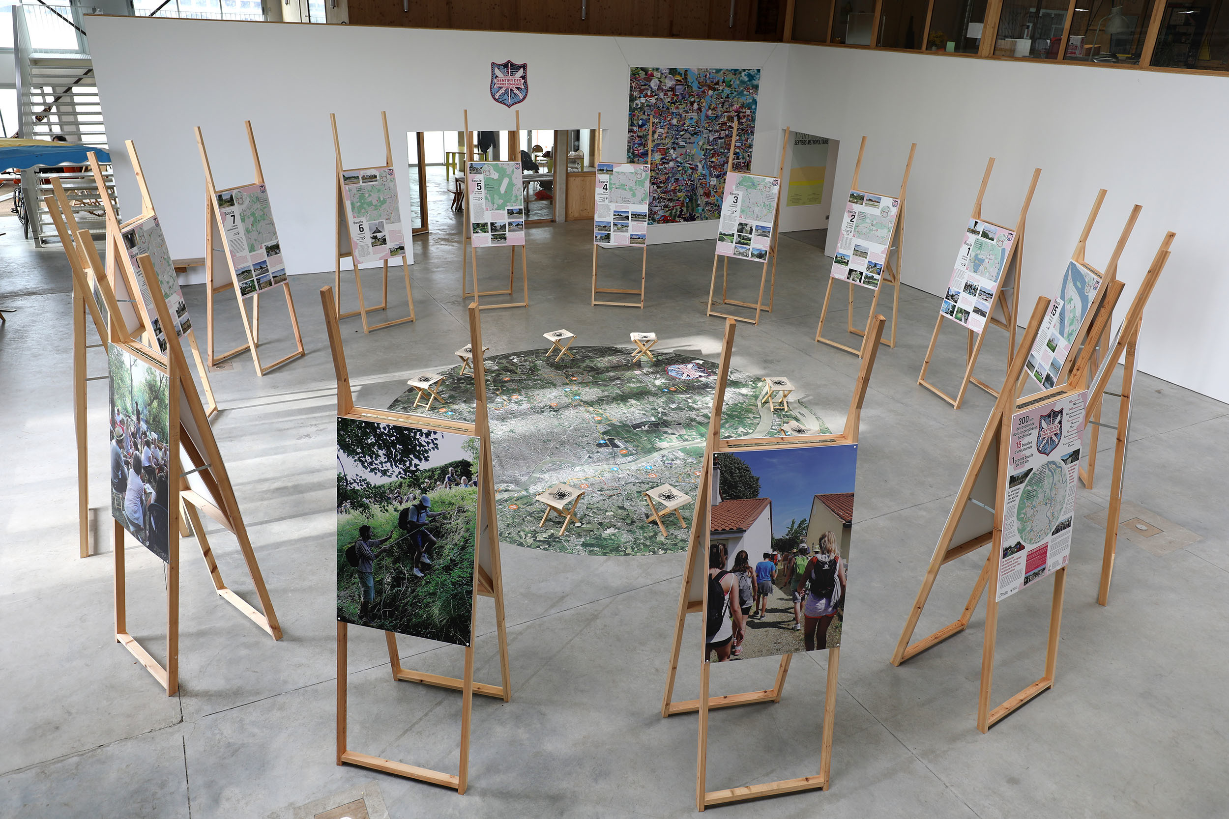
The route, in the form of a chain with links, is made up of 15 joined loops.
Each loop corresponds to a day’s walk.
A large loop of 170 km, running from one loop to the other, makes it possible to walk around the whole city in 9 days.
The Common Lands Trail by the Numbers
- 300 km of described itineraries
- 15 one-day loops
- 1 large loop of 170 kms
- 60 km in common with the GR® Metropolitain
- 160 km on footpaths
- 140 km on roads
- 1600 m of cumulative positive height difference
- 45 km along rivers
- 13 km along the ring road
- 14 points of view
- 22 ring road crossings
- 28 parks, 22 housing estates, 6 social housing complexes, 5 commercial areas, 4 industrial areas, 2 wetlands and 37 roundabouts crossed.
Download the topoguides of the 15 loops (pdf) and the route of the trail (gpx) :
- Topoguide Boucle 1 (pdf) : Entre fleuve et lac (Bordeaux, Bruges)
- Topoguide Boucle 2 (pdf) : Autour de la vallée des Jalles (Blanquefort, Le Taillan-Médoc, Eysines, Bruges)
- Topoguide Boucle 3 (pdf) : Cocktail résidentiel (Eysines, St-Médard-en-Jalles, Le Haillan)
- Topoguide Boucle 4 (pdf) : Dérive pavillonnaire (St-Médard-en-Jalles, St-Aubin-du-Médoc, Le Taillan-Médoc)
- Topoguide Boucle 5 (pdf) : La conquête de l’Ouest (Martignas-sur-Jalle, St-Médard-en-Jalles)
- Topoguide Boucle 6 (pdf) : Zoneland (Le Haillan, St-Médard-en-Jalles, Mérignac)
- Topoguide Boucle 7 (pdf) : Lisières pavillonnaires (Pessac, Mérignac)
- Topoguide Boucle 8 (pdf) : Bordures et franchissements (Passac, Canéjan, Gradignan)
- Topoguide Boucle 9 (pdf) : Et au milieu coule une rivière (Villenave d’Ornon, Talence, Gradignan)
- Topoguide Boucle 10 (pdf) : Une histoire d’eau (Bègles, Villenave d’Ornon)
- Topoguide Boucle 11 (pdf) : Montagnes russes (Floirac, Tresses, Latresne, Bouliac)
- Topoguide Boucle 12 (pdf) : Balcons sur la ville (Cenon, Artigues-près-Bordeaux, Floirac)
- Topoguide Boucle 13 (pdf) : Balcons sur la ville 2/2 (Lormont, Bassens, Carbon-Blanc)
- Topoguide Boucle 14 (pdf) : Façon puzzle (Ambarès-et-Lagrave, St-Louis-de-Montferrand, St-Vincent-de-Paul, Bassens, Carbon-Blanc)
- Topoguide Boucle 15 (pdf) : Presqu’au bout du monde (Ambès)
- Tracé du sentier (gpx)
Suburban Walks,
An extraordinary journey into the ordinariness of our contemporary cities
A dive into the urban interstices
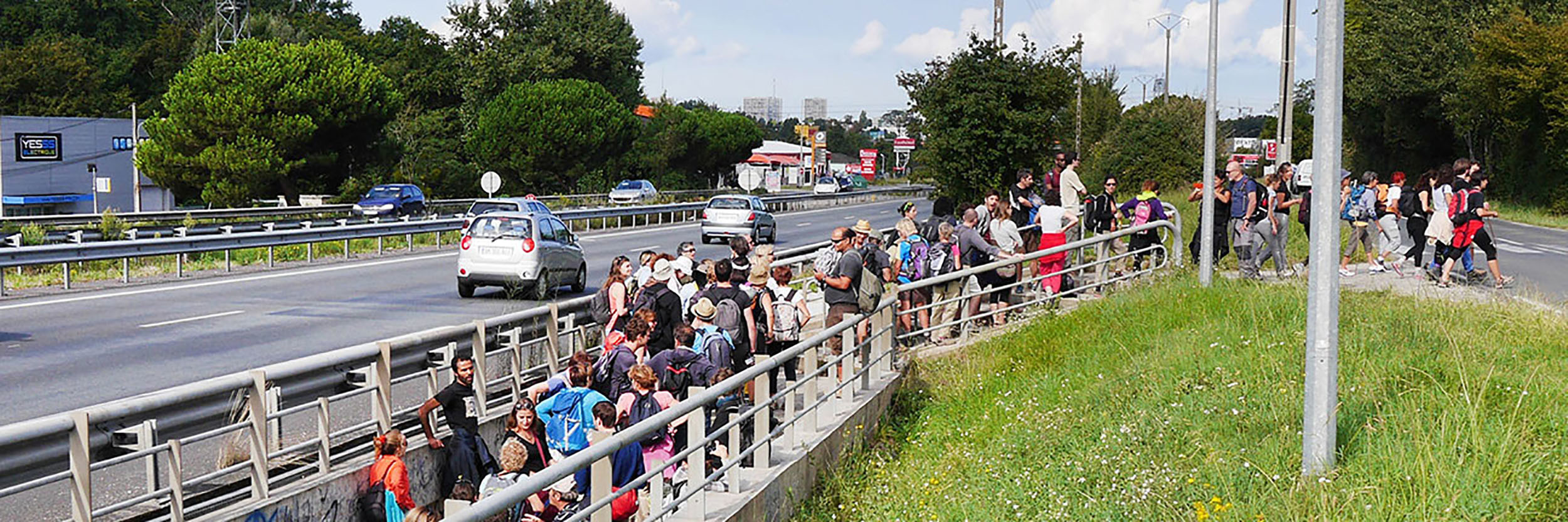
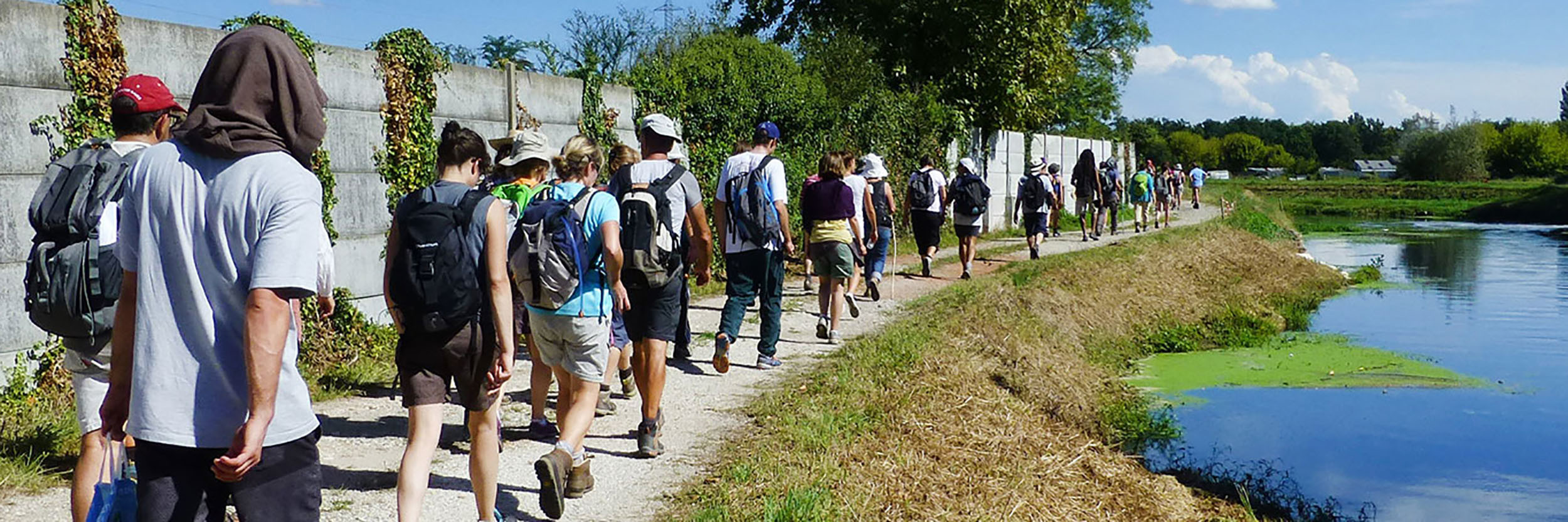
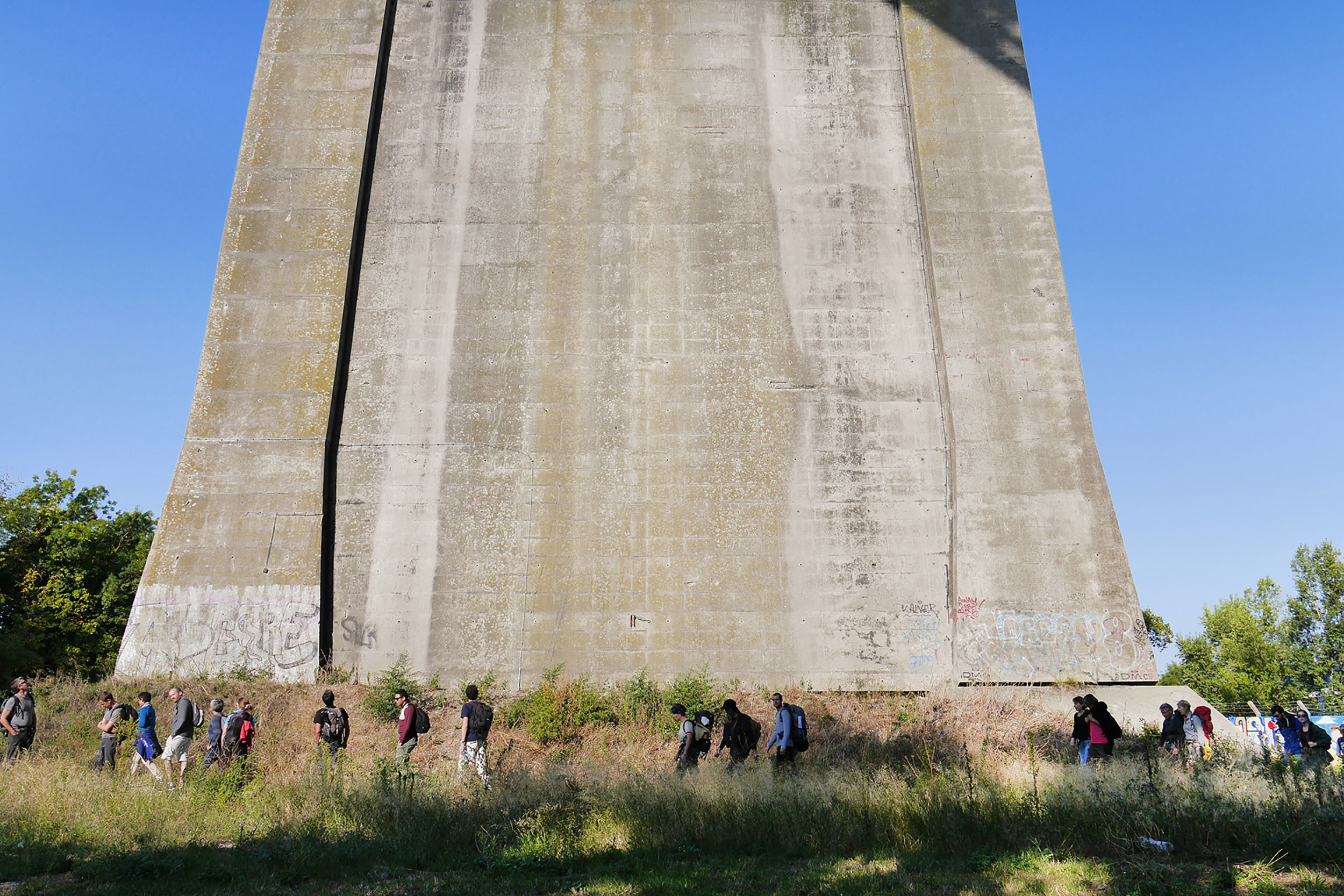
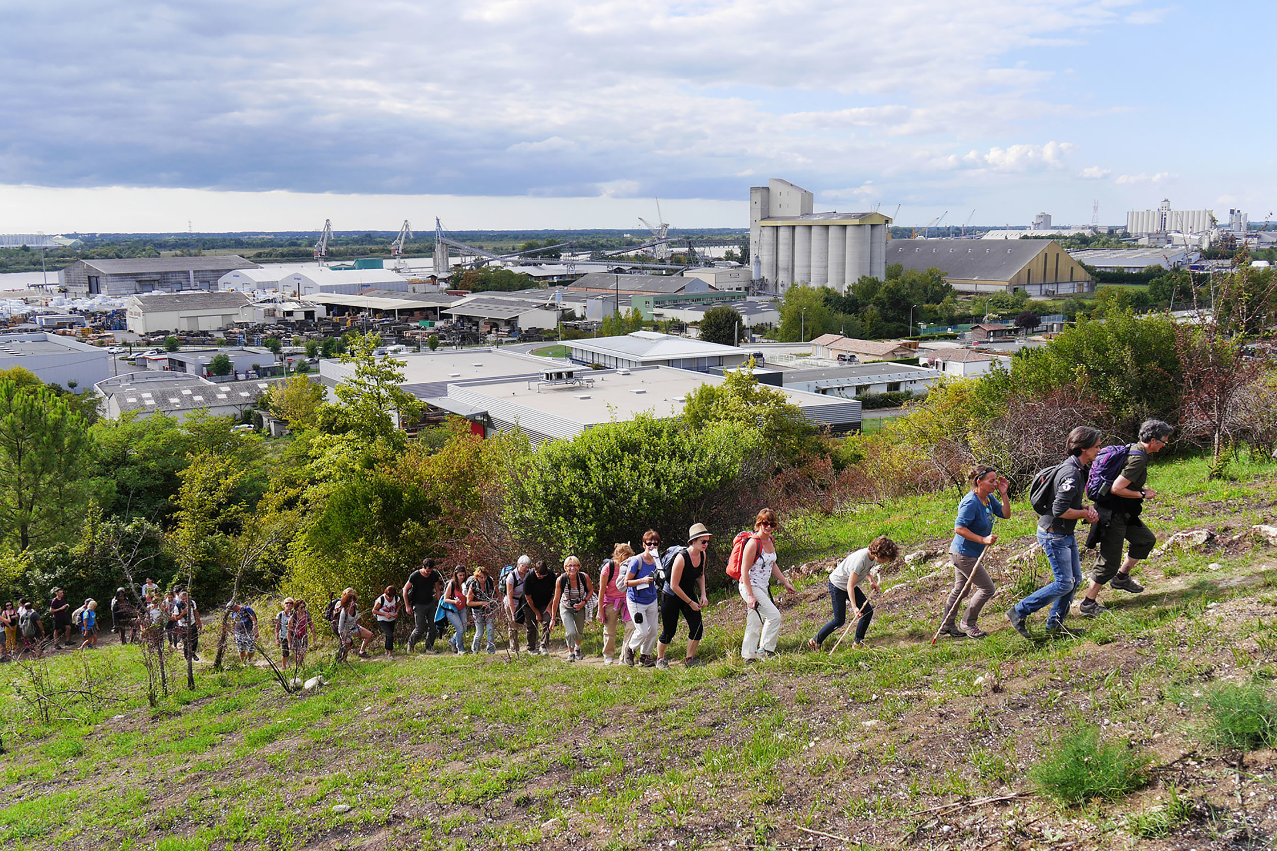
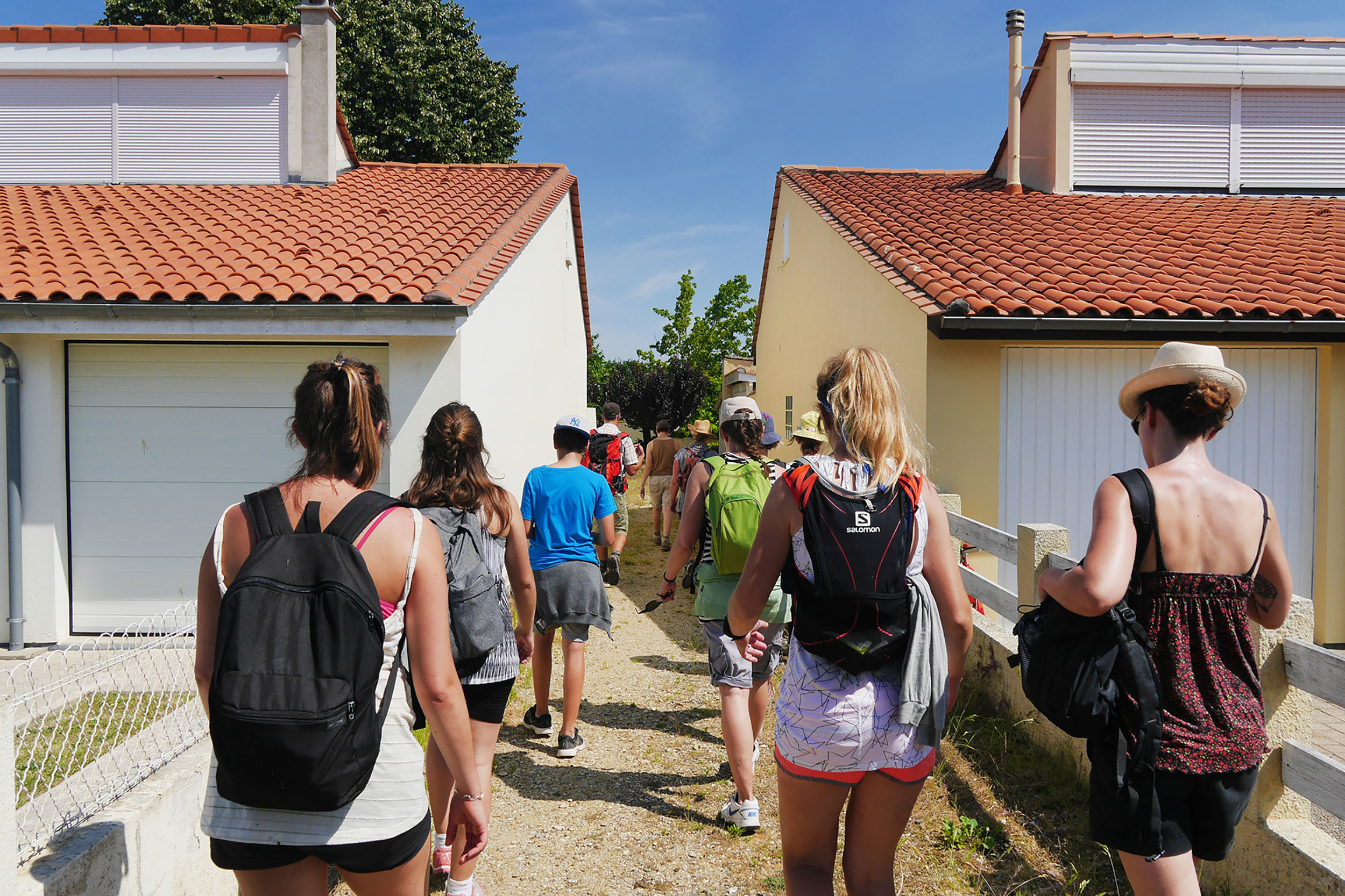
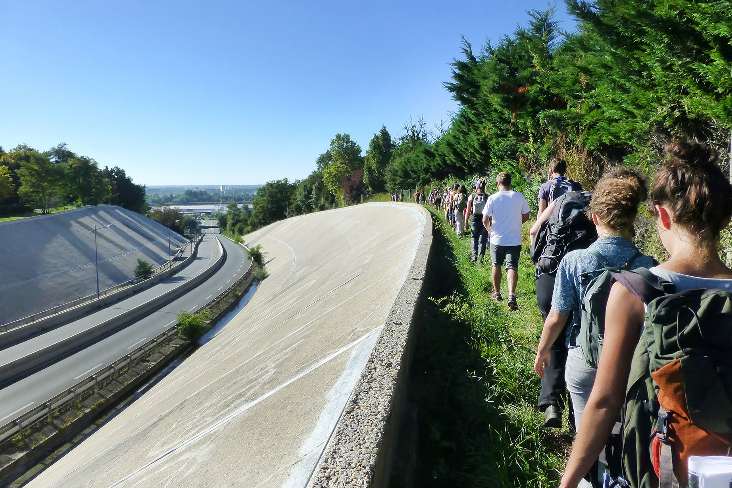
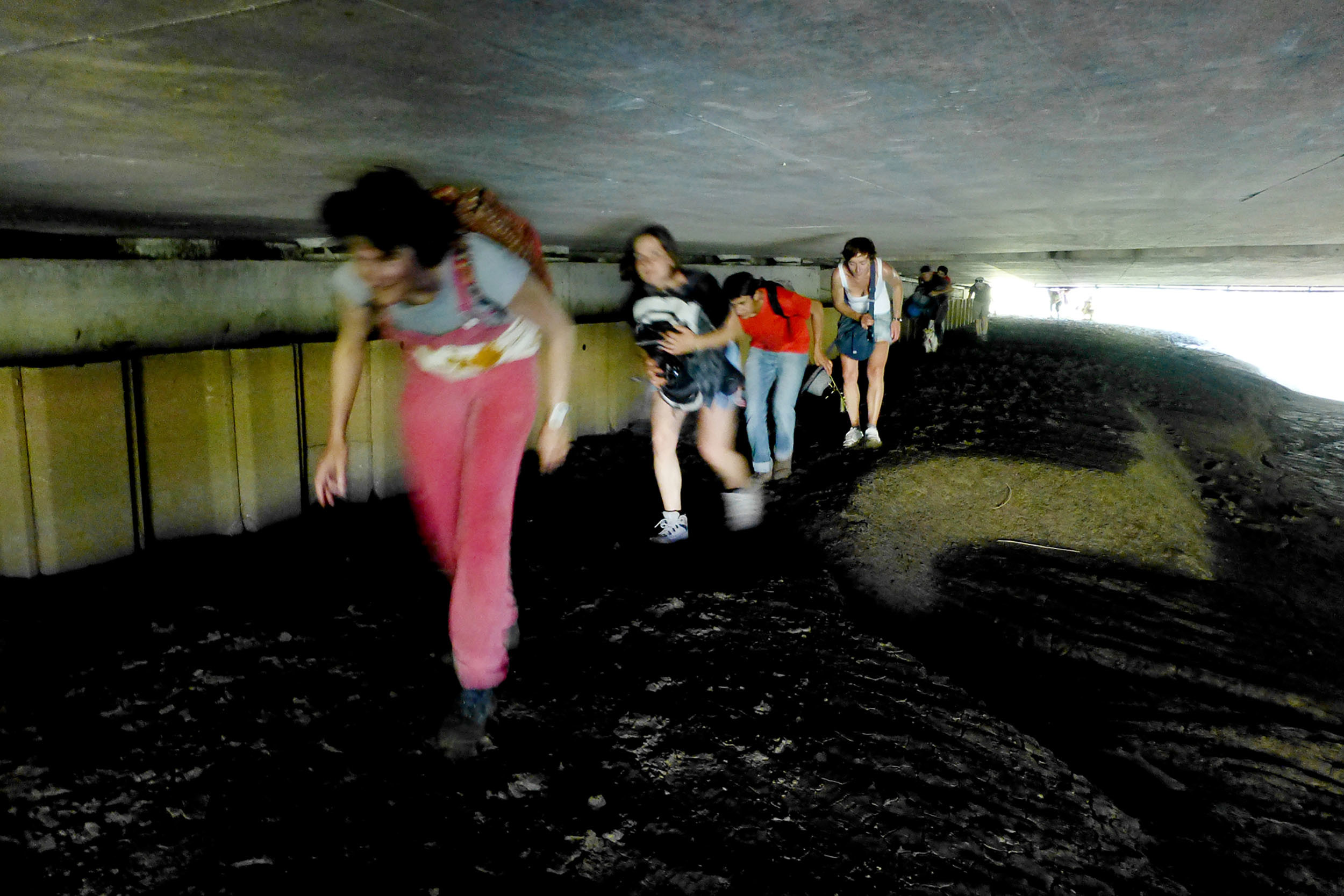
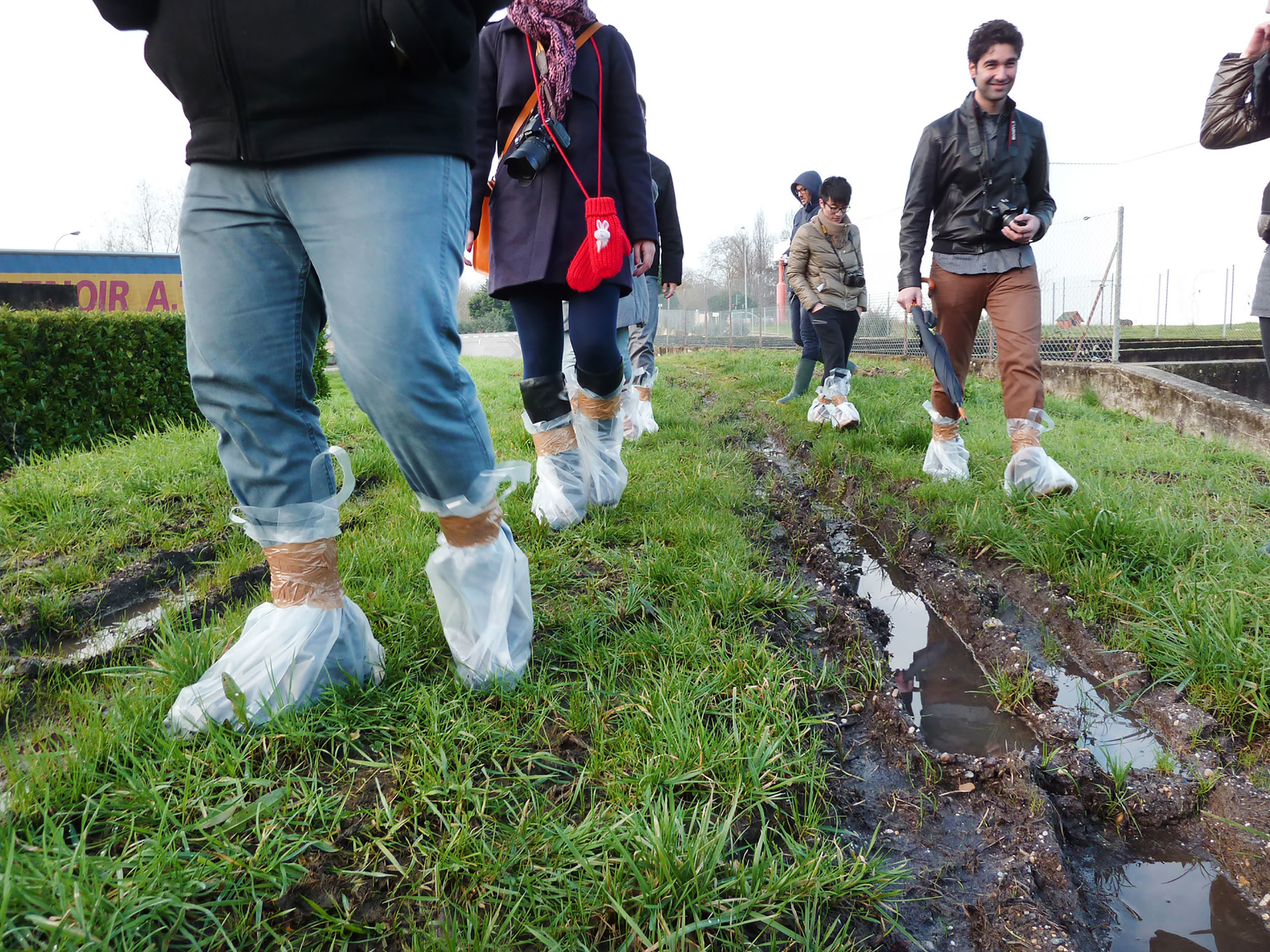
The Suburban Walks are exploratory walks through the outskirts of the cities. They cross and connect hybrid and fragmented landscapes, composed of housing estates, social housing complexes, old towns, expressways, industrial and commercial areas, car parks and electricity pylons, but also unexpected parks and gardens, forgotten forests, old paths and especially uncountable abandoned spaces where wild nature develops, out of sight. This diffuse and involuntary nature represents a tremendous potential for escape and resourcing, a kind of exoticism of proximity.
The suburbs, a land of adventure and exploration
The suburban area has developed to respond effectively to our modern needs for housing, travel, consumption and production.
The resulting chaotic urbanism is often considered useful but uninteresting, and above all devoid of the qualities that make up the city and the pleasures it provides.
However, the urban outskirts have richness to reveal, resources that could change our viewpoint and practices, and build a sense of suburbanity : a huge territory, a great diversity of landscapes, an unsuspected architectural heritage…
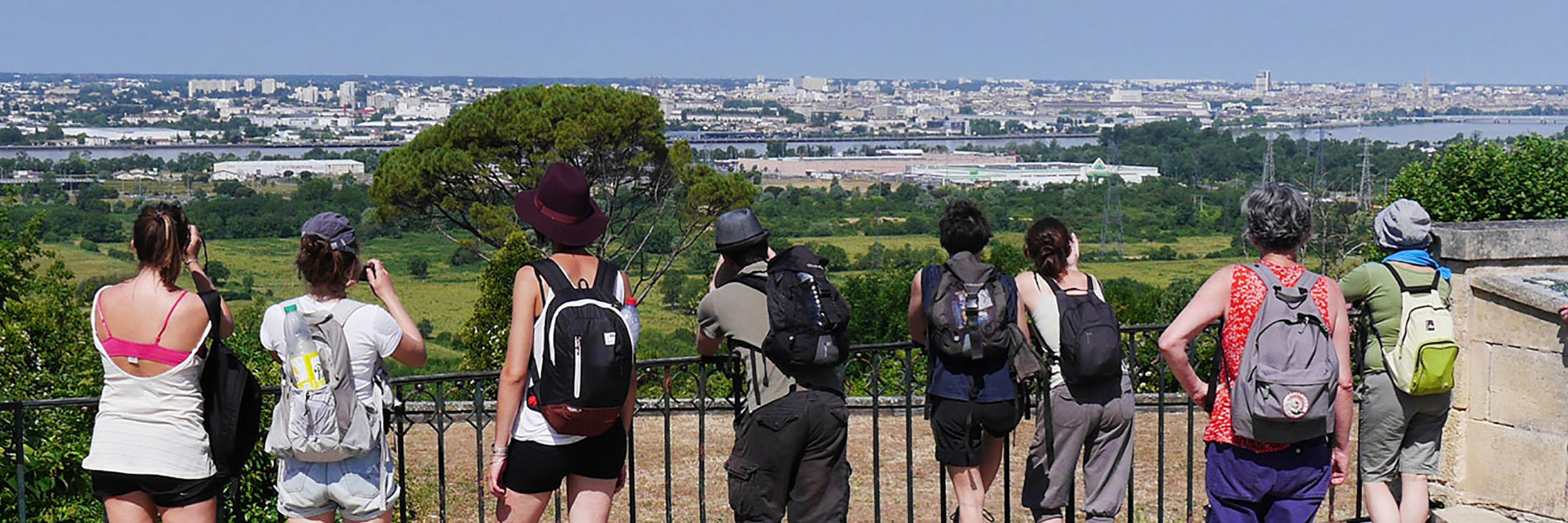
Could we not, from this point of view, consider the suburban area as a land of adventure and exploration, like the great natural spaces ? And imagine hiking in the outskirts as we do in the mountains or in the countryside ?
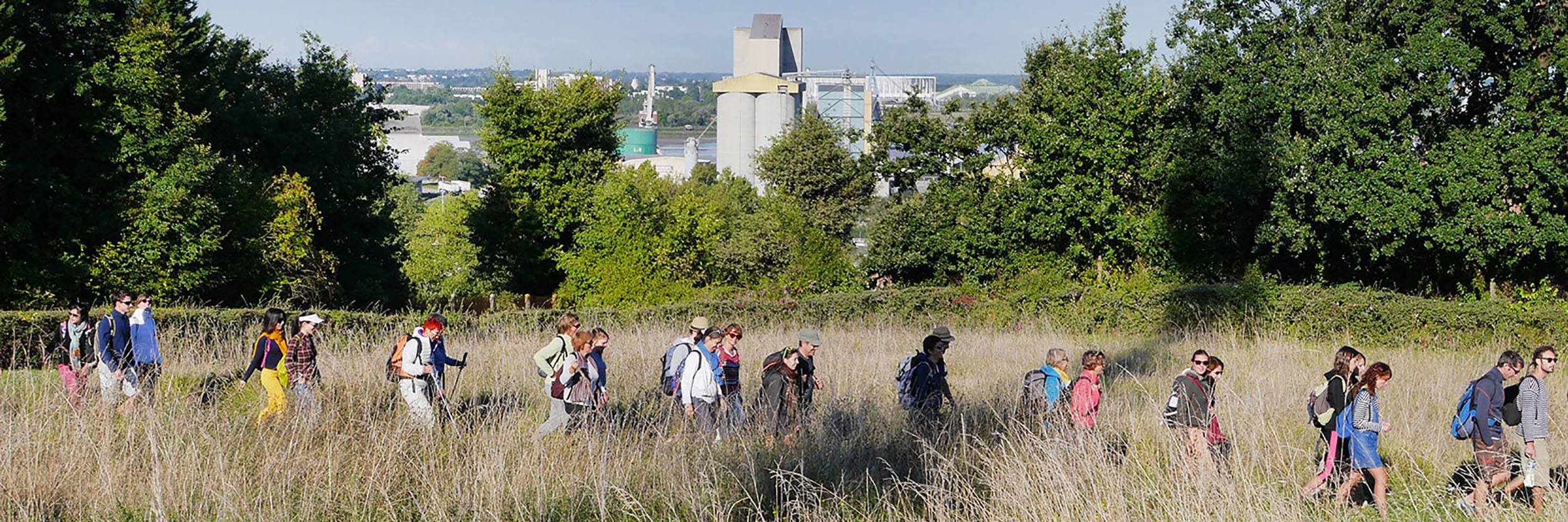
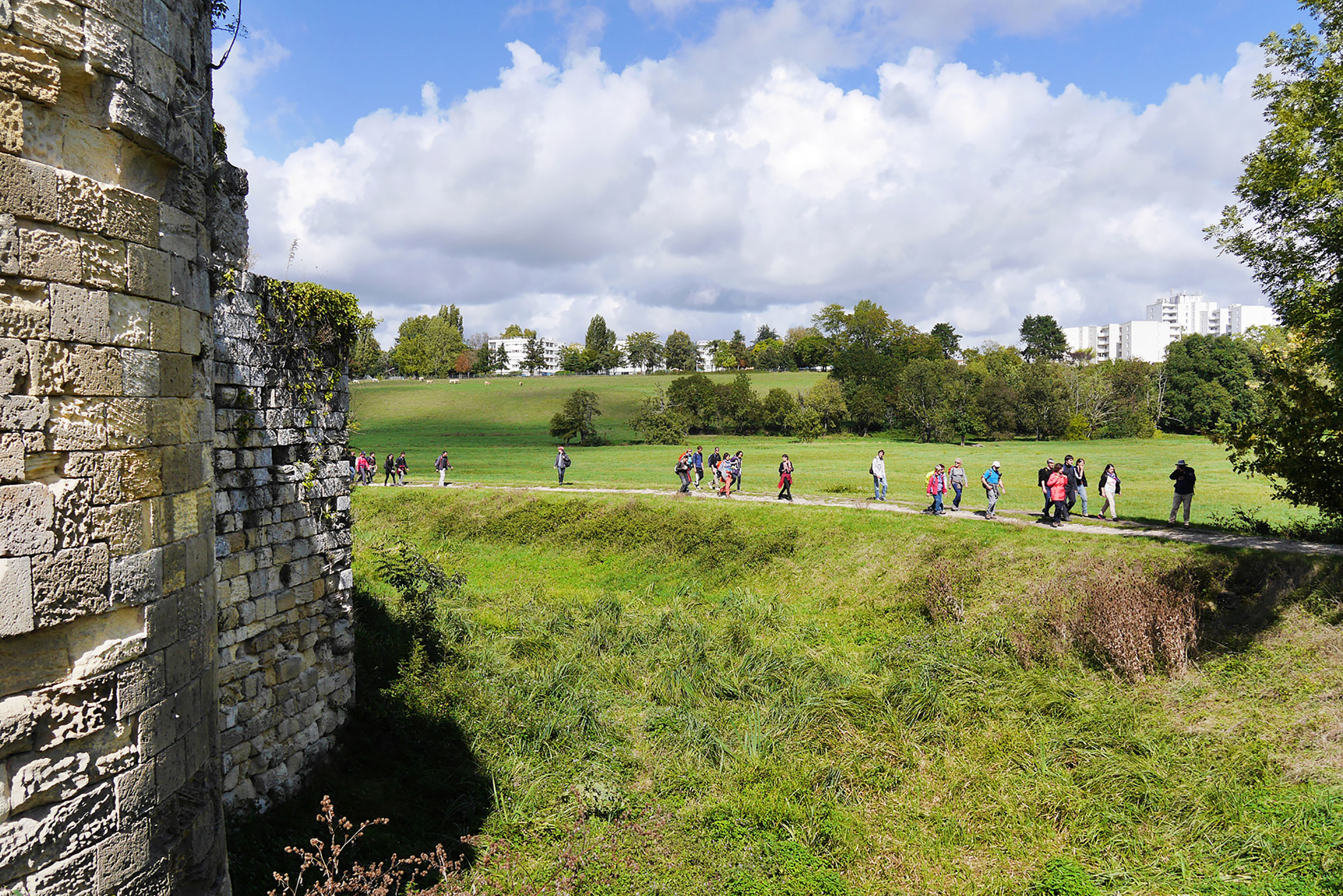
The suburbs offer a new hiking experience. The hybrid and eclectic nature of the territories crossed, where places, atmospheres and sounds follow one another like a continuous zapping, constantly stimulates our senses and gives the walk a new dynamic.
The Bordeaux suburbs, unsuspected landscapes
The Bordeaux outskirts are similar to the outskirts of other French and European cities. It has all the generic ingredients of the suburban area : commercial and industrial activity zones, residential areas, social housing estates, road infrastructures, wasteland…
But it is also a singular and unique territory where the extraordinary hides behind the ordinary. First and foremost, it is distinguished by a great diversity of landscapes. Remarkable entities that have resisted to the pressures of urban development and that today draw a hollow city that we are now trying to protect and enhance.
In the north, the large wetlands of the marshes of the peninsula and Parc des Jalles, suitable for growing vegetables, grazing and gravel pits.
In the south, the rich wine growing hills of Pessac-Léognan and Graves.
In the east, the wild meander of the hillsides, forming a balcony overlooking the town.
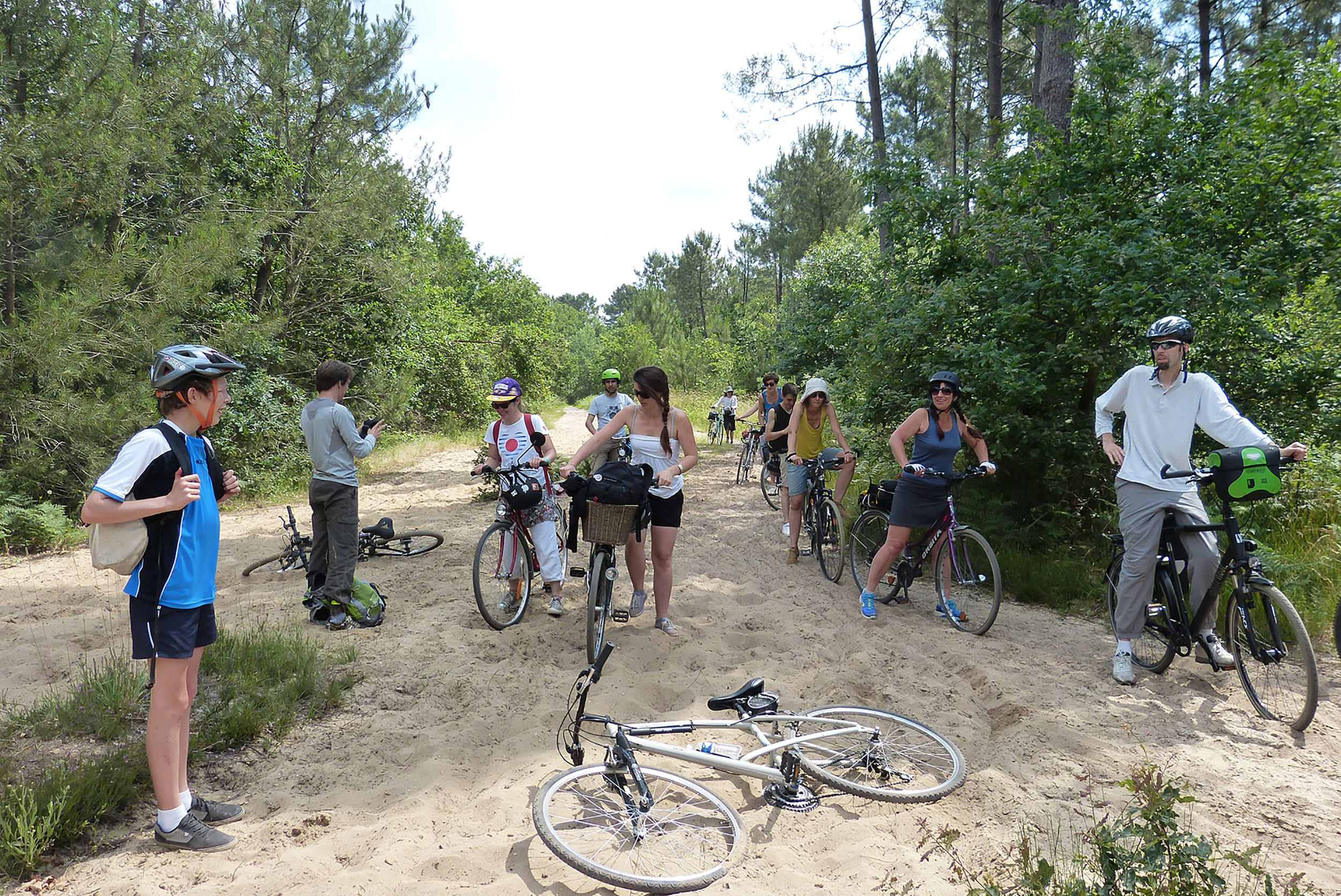
In the west finally, the sandy lands and the large pine forests, announcing the infinite landscape of the Landes.
Imperceptibly, rivers cross the city and form long interstices of nature at the bottom of micro valleys : l’Eau bourde, les Jalles, le Gua, le Peugue.
Many major parks surround the town : the Majolan Park and its false romantic ruins (Blanquefort), the Hermitage Park, a gaping hole dug into the hillsides (Lormont), the Bourgailh site with its monumental lookouts and its hill of buried waste (Pessac), the Burthe Domain, which looks like a primary forest (Floirac)…
Innumerable forgotten nuggets and curiosities reappear : abandoned castles buried under the vegetation (Château du Dragon in Bouliac, Domaine de Bel Sito in Floirac), the ruins of an 11th century medieval fortress (Blanquefort), a troglodyte chapel (l’Ermitage in Lormont), Underground stone quarries (Lormont), a building that looks like a Russian dacha (Chalet Alexandre in Lormont), abandoned tennis courts, remnants of a lost fashion (there are about a hundred of them!)…
And to connect all these places, an invisible and sprawling network of paths : old rural roads, spontaneous paths, alleys of housing estates…. Combined, they represent a length of 1200 km, the round trip distance between Bordeaux and Paris !
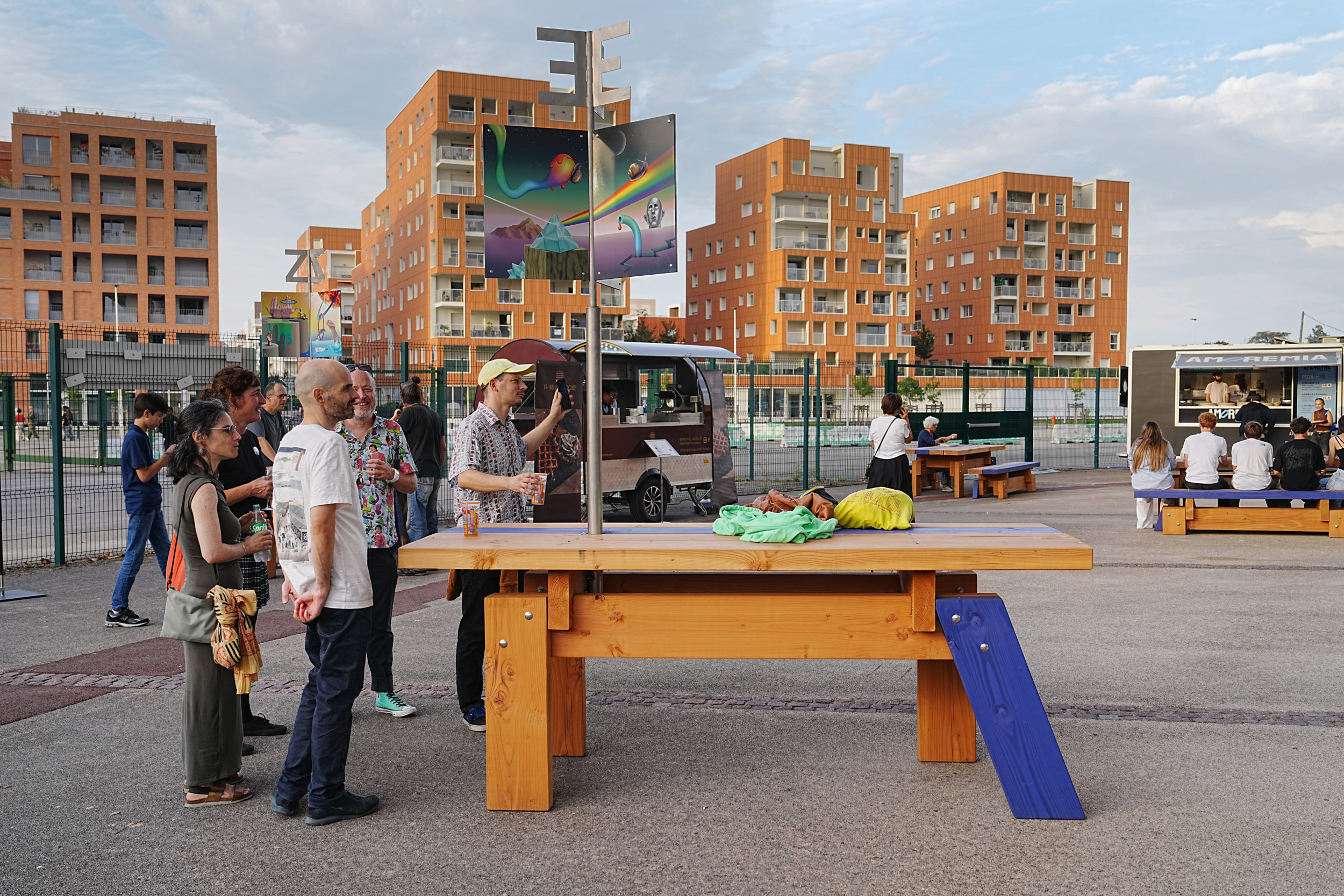
Finally, the fringes of the Bordeaux suburban area are obviously inhabited and appropriate places. Far from the hustle and bustle of the urban centres, a discreet life unfolds there : the ephemeral and DIY restaurants of the “Dames du Lac” (Bordeaux), the children’s huts around the residential areas, the more or less official vegetable gardens, the traces of wild barbecues, modern hermits and marginal poets ?
The origin of the project
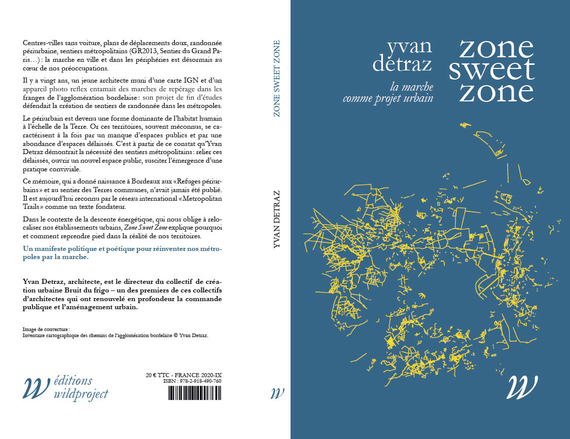
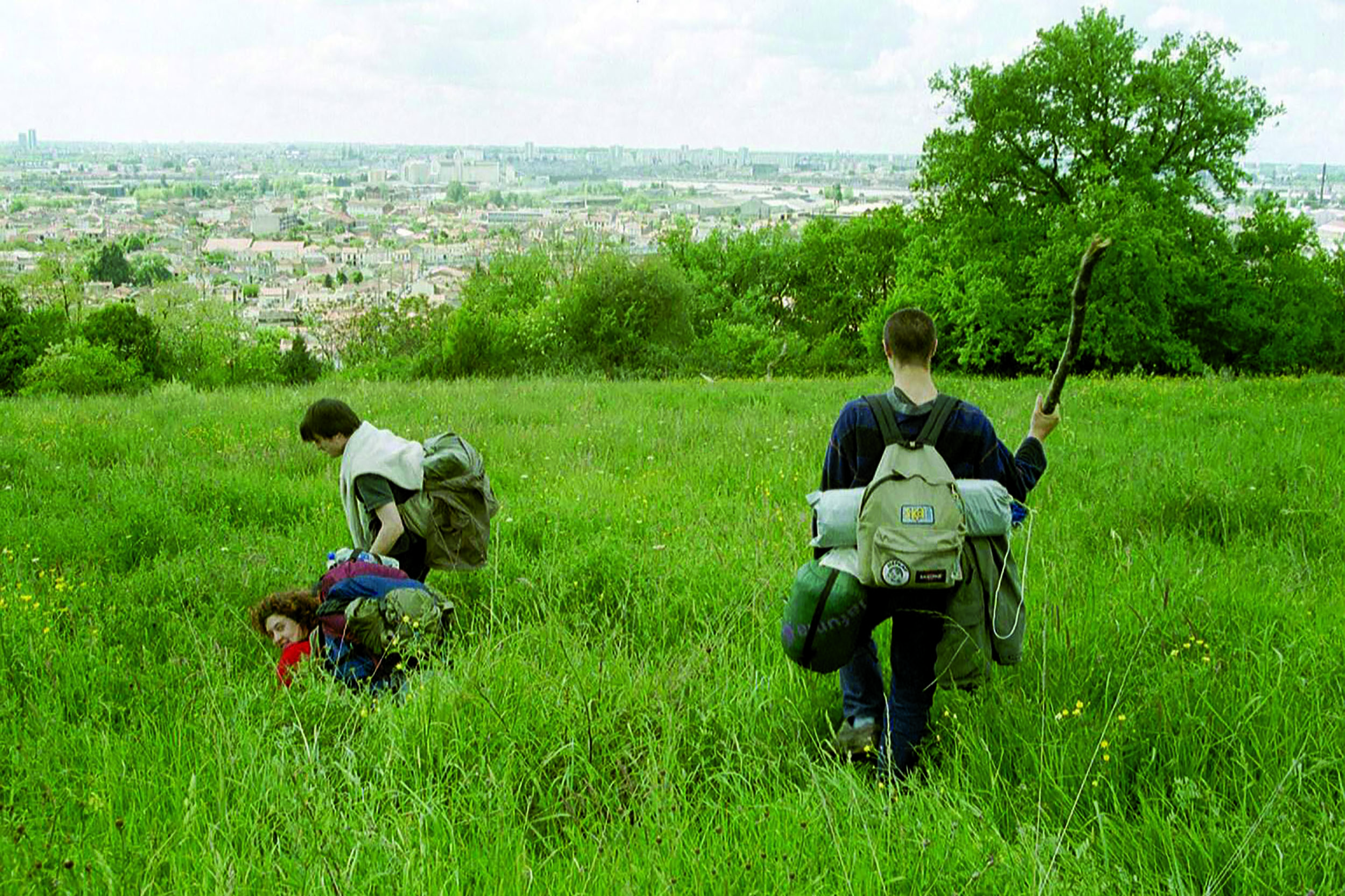
In 1999, Yvan Detraz, then an architecture student and co-founder of Bruit du frigo, led a 3-month, 1000 km walking expedition through the Bordeaux suburbs to map neglected spaces and paths. Before Google map and with the help of a simple geographical map, this mission sought to reveal the potential for escape from the Bordeaux suburbs and to develop a walking culture. (see “Zone sweet zone”).
It is from this founding experience that the concepts of the Suburban Walk and the Suburban Refuge were born.
If in 1999, nobody imagined hiking in the middle of the housing estates or along the ring road, today more and more curious people want to discover their city differently by venturing off the beaten track.
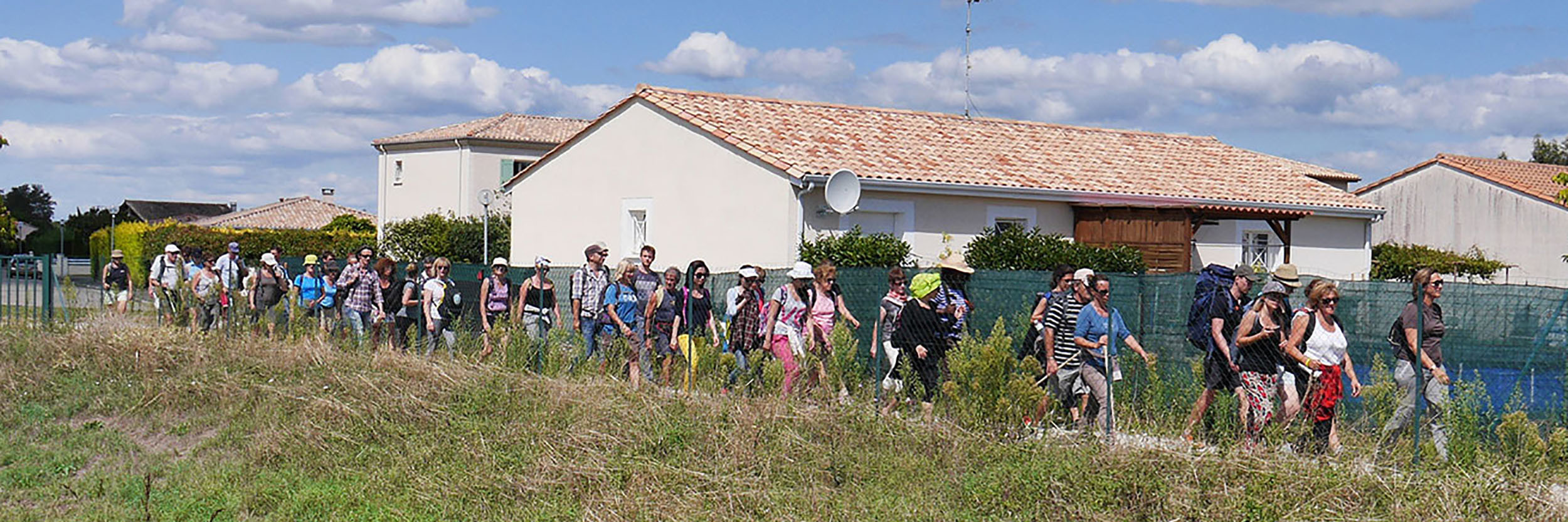
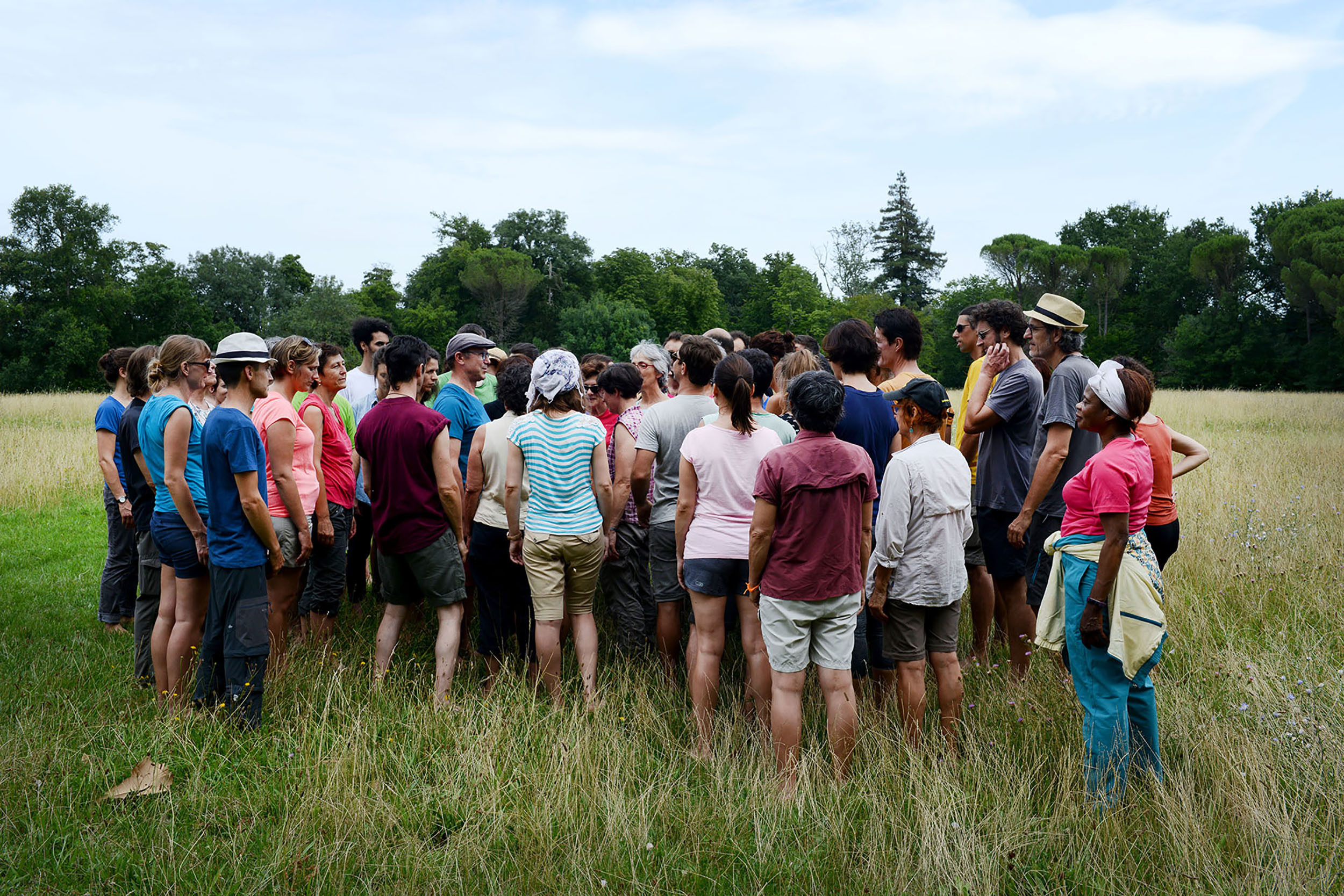
The collective suburban walks that we organise around Bordeaux bring together a large and eclectic public : families, students, walking clubs, seniors… The Suburban Shelters, which offer a unique immersive experience, are also very successful.
It is to respond to this search for exoticism of proximity that we wanted to create this trail and share our knowledge of the territory and its hidden treasures.
Metropolitan Trails Network
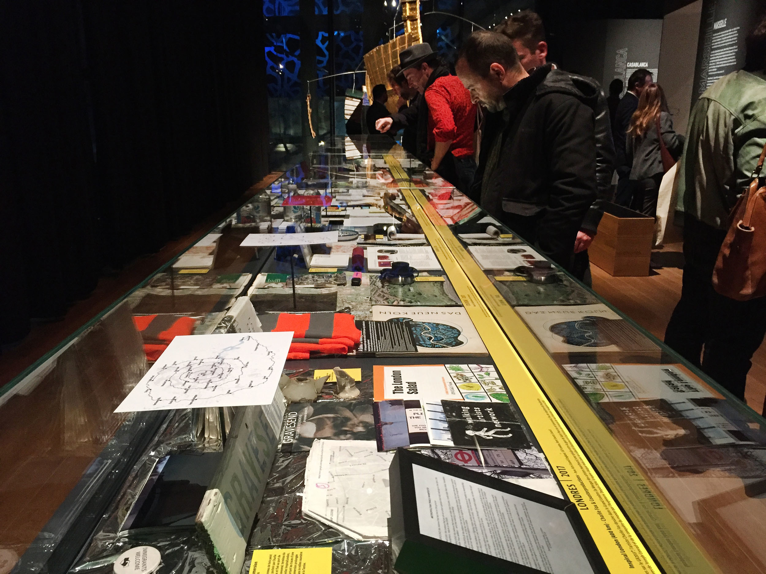
The Common Lands Trail of Bordeaux is a member of the Metropolitan Trails network which includes the trails of Paris, Marseille, Bordeaux, Avignon, Milan, London, Cologne, Athens, Tunis, Istanbul and Boston.
This network was created in 2017 in Marseille, on the occasion of the exhibition on the Metropolitan Trails organised at the Mucem (as part of the permanent exhibition “Connectivités“). It was initiated and is led by Baptiste Lanaspeze (editor – Editions Wildproject) and Paul-Hervé Lavessière (Geographer).
The first National Assises of the Metropolitan Trails were organised on 8 November 2018 at the Mucem in Marseille.
” The Metropolitan Trails are public spaces of a new kind. Transport infrastructures, tourist facilities, off-wall cultural centres, citizen platforms, training areas… they allow us to rediscover our living spaces and to foster the emergence of a common culture.
Urban hiking is a social phenomenon, a deep-rooted movement. Coming from the worlds of art and planning, it now interests a large public.
Metropolitan trails are an international innovation, born in France. »
Extract from the website : National Network of Metropolitan Trails
- Presentation of the National Network of Metropolitan Trails
- Charter of the National Network of Metropolitan Trails
Suburban Walks
An extraordinary journey
into the ordinariness of our contemporary cities
A dive into the urban interstices
The Suburban Walks are exploratory walks through the outskirts of the cities. They cross and connect hybrid and fragmented landscapes, composed of housing estates, social housing complexes, old towns, expressways, industrial and commercial areas, car parks and electricity pylons, but also unexpected parks and gardens, forgotten forests, old paths and especially uncountable abandoned spaces where wild nature develops, out of sight. This diffuse and involuntary nature represents a tremendous potential for escape and resourcing, a kind of exoticism of proximity.
The suburbs, a land of adventure and exploration
The suburban area has developed to respond effectively to our modern needs for housing, travel, consumption and production.
The resulting chaotic urbanism is often considered useful but uninteresting, and above all devoid of the qualities that make up the city and the pleasures it provides.
However, the urban outskirts have richness to reveal, resources that could change our viewpoint and practices, and build a sense of suburbanity : a huge territory, a great diversity of landscapes, an unsuspected architectural heritage…
Could we not, from this point of view, consider the suburban area as a land of adventure and exploration, like the great natural spaces ? And imagine hiking in the outskirts as we do in the mountains or in the countryside ?
The suburbs offer a new hiking experience. The hybrid and eclectic nature of the territories crossed, where places, atmospheres and sounds follow one another like a continuous zapping, constantly stimulates our senses and gives the walk a new dynamic.
The origin of the project
In 1999, Yvan Detraz, then an architecture student and co-founder of Bruit du frigo, led a 3-month, 1000 km walking expedition through the Bordeaux suburbs to map neglected spaces and paths. Before Google map and with the help of a simple geographical map, this mission sought to reveal the potential for escape from the Bordeaux suburbs and to develop a walking culture. (see “Zone sweet zone”).
It is from this founding experience that the concepts of the Suburban Walk and the Suburban Refuge were born.
If in 1999, nobody imagined hiking in the middle of the housing estates or along the ring road, today more and more curious people want to discover their city differently by venturing off the beaten track.
The collective suburban walks that we organise around Bordeaux bring together a large and eclectic public : families, students, walking clubs, seniors… The Suburban Shelters, which offer a unique immersive experience, are also very successful.
It is to respond to this search for exoticism of proximity and to share our knowledge of the territory and its hidden treasures that we have created the Common Land Trail.
The Metropolitan Trails Network
The Common Lands Trail of Bordeaux is a member of the Metropolitan Trails Network, created in 2017 in Marseille, on the occasion of the exhibition about the Metropolitan Trails organized at the Mucem Museum (as part of the permanent exhibition “Connectivities”).
This national network (Paris, Marseille, Bordeaux, Avignon) was created as a continuation of the international Metropolitan Trails network (Milan, London, Cologne, Istanbul, New York…) initiated and piloted by Baptiste Lanaspeze (editor – Editions Wildproject) and Paul-Hervé Lavessière (Geographer).
The first National Assises of the Metropolitan Trails were organised on 8 November 2018 at the Mucem in Marseille.
” The Metropolitan Trails are public spaces of a new kind. Transport infrastructures, tourist facilities, off-wall cultural centres, citizen platforms, training areas… they allow us to rediscover our living spaces and to foster the emergence of a common culture.
Urban hiking is a social phenomenon, a deep-rooted movement. Coming from the worlds of art and planning, it now interests a large public.
Metropolitan trails are an international innovation, born in France. »
Extract from the website : National Network of Metropolitan Trails
Exhibition Nouvelles Saisons, arc en rêve centre d'architecture

The Gleaners
French Vexin Regional Nature Park
Common lands trail & Art of metropolitan trails
Cross-exhibitions Bordeaux

Hyderabad Urban Trail
Hyderabad – India

Dérive droite
The Walks of panOramas Floirac, Cenon, Lormont, Carbon-Blanc, Bassens
Zone Sweet Zone
Walk as urban project Bordeaux

Moving grouped
Bordeaux, Lormont

Walk around the Shelters #10
Le Haillan > Saint-Médard-en-Jalles
Common Lands Trail
Great Bordeaux
The Common Lands Trail at the Mucem
Marseille
AtTEnTIOn à La mArcHE !
Bordeaux
Walk around the Shelters #9
Le Haillan > Bruges
Walk around the Shelters #8
Lormont > Ambares-et-Lagrave

Walk around the Shelters #7
Floirac > Bassens
Walk around the Shelters #6
Lormont > Saint-Vincent-de-Paul
Walk around the Shelters #5
Pessac > Floirac

Tournée générale
Pau

Secret expedition
Lormont

Walk around the Shelters #4
Martignas-sur-Jalle > Bordeaux
Walk around the Shelters #3
Around the CUB, left bank
Walk around the Shelters #2
Ambes > Lormont
Walk around the Shelters #1
Gradignan > Bègles
Rocade walk
Bègles

Guest Garden
Royan
The crossing of the hillsides of Bordeaux
Floirac > Bassens
Suggested itineraries
Saint-Quentin-en-Yvelines
The Tour of Bordeaux
Bordeaux periphery, left bank

Zone Sweet Zone
Bordeaux outskirts
Last
projects
> all projectsAt the crossroads of art, territories and populations, our approach aims to promote the transition to sustainable, shared and welcoming cities, by proposing alternative ways of imagining and building our living environment and by exploring new forms of public space.
Goûtu
Come with an appetite Entre deux mers - La Sauve - Saint Germain de Grave - Le Tourne
E’POP!
Espaces Publics Ombragés Portatifs Bordeaux
F.C. WATA
Fabrique Collective du Lac Municipal Yaoundé – Cameroon
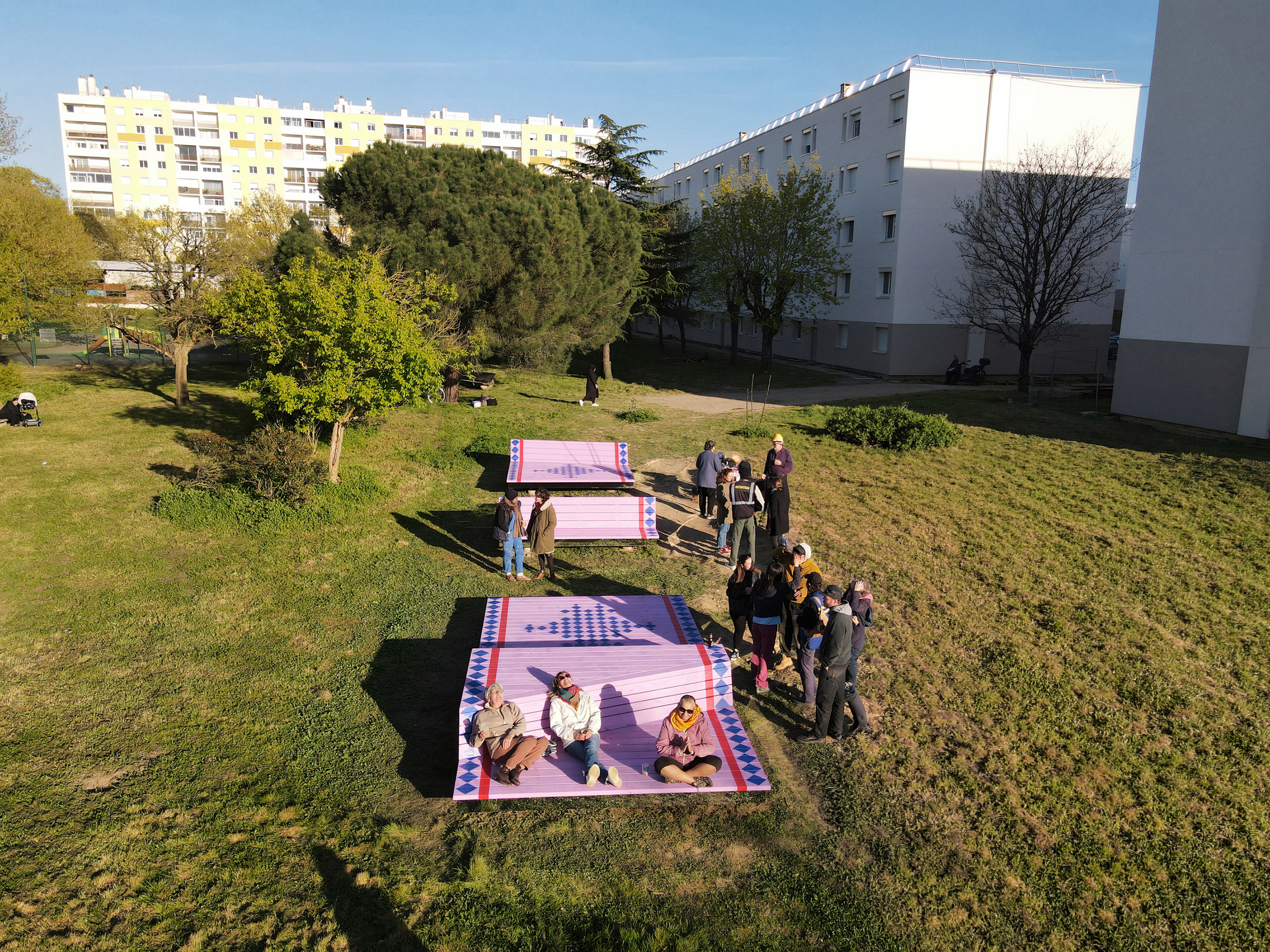
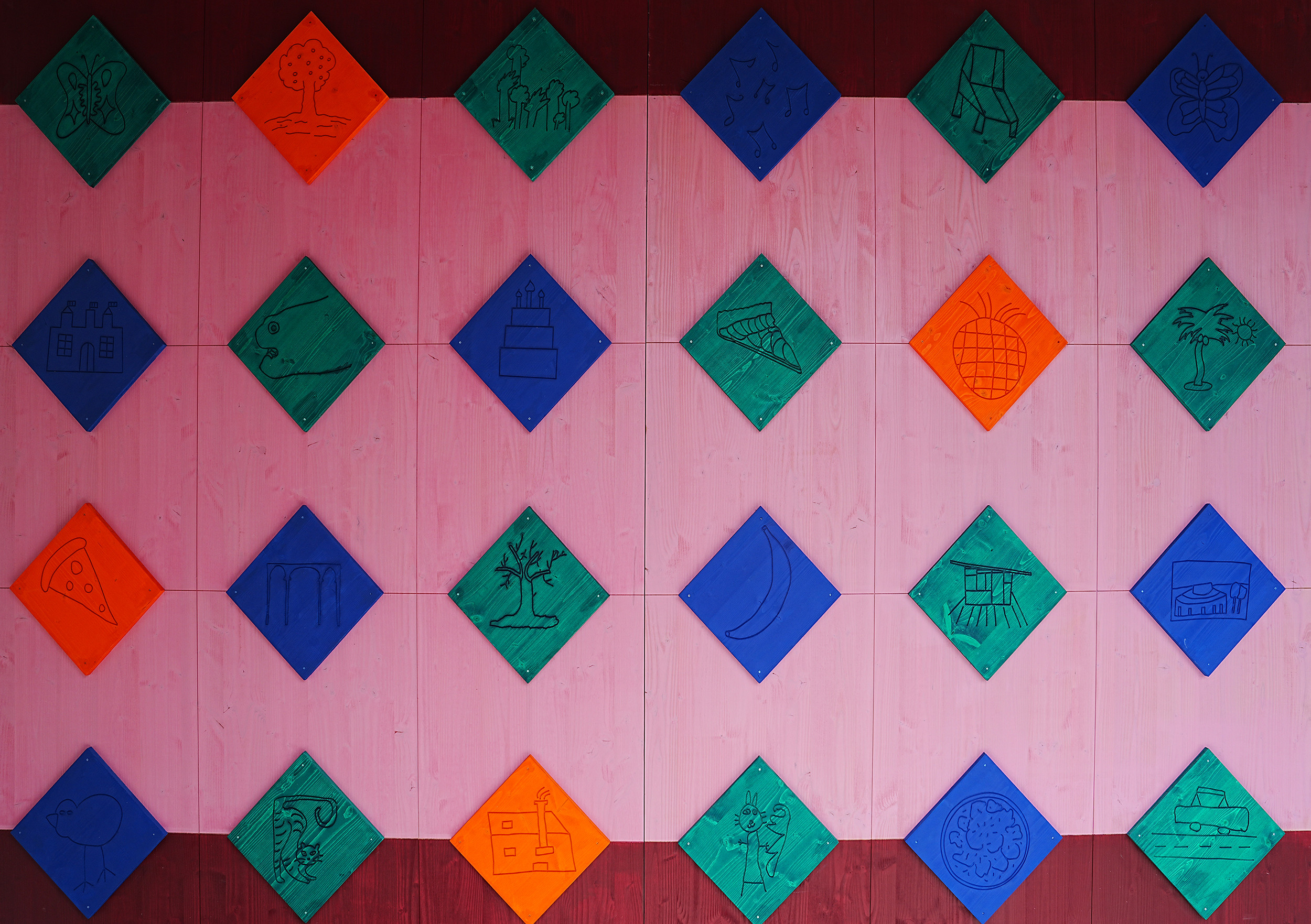
The Flying Carpet
Cenon
Carved in wood
Bordeaux
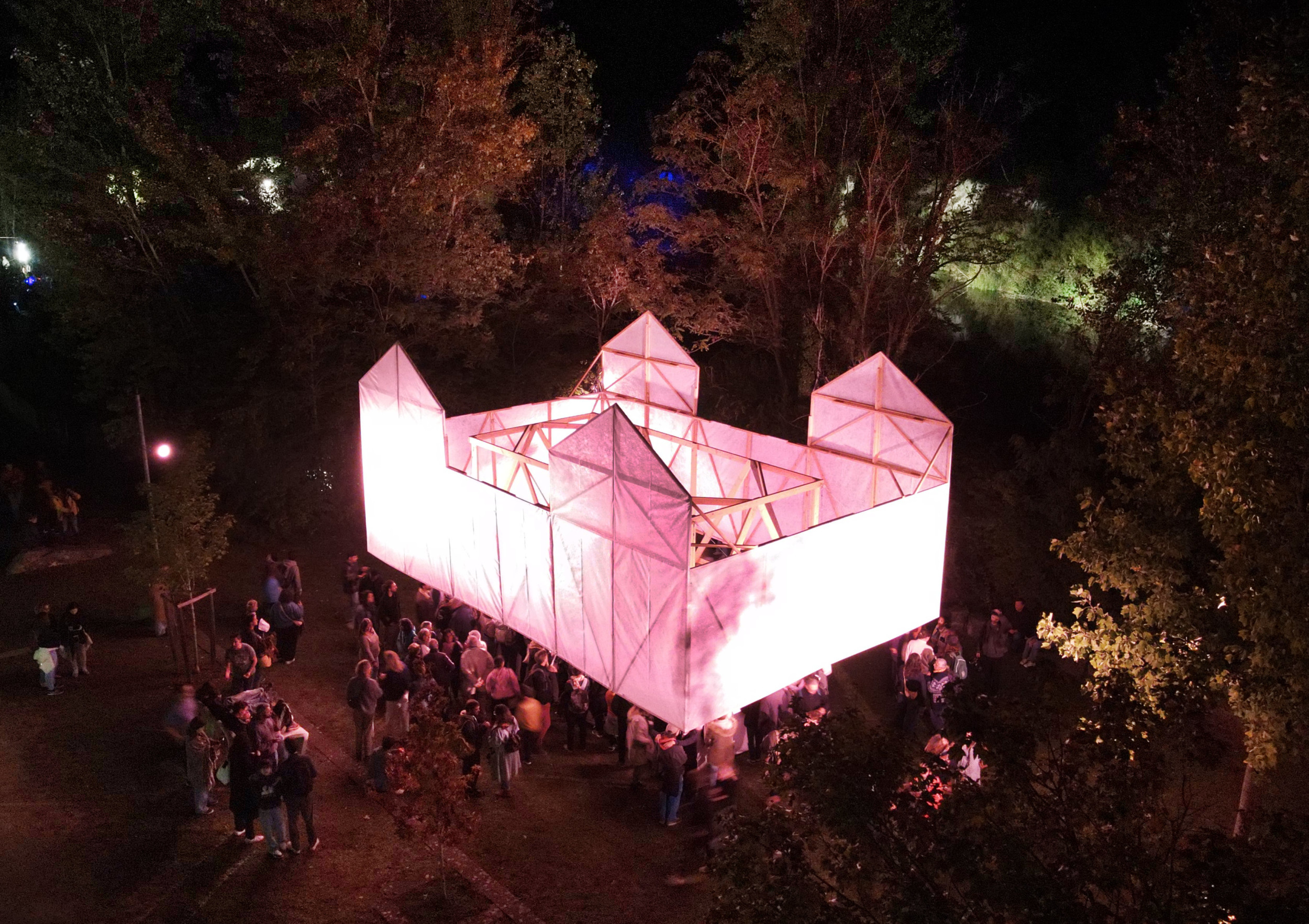
Praline castle
La Nuit Verte, biennale de panoramas Lormont
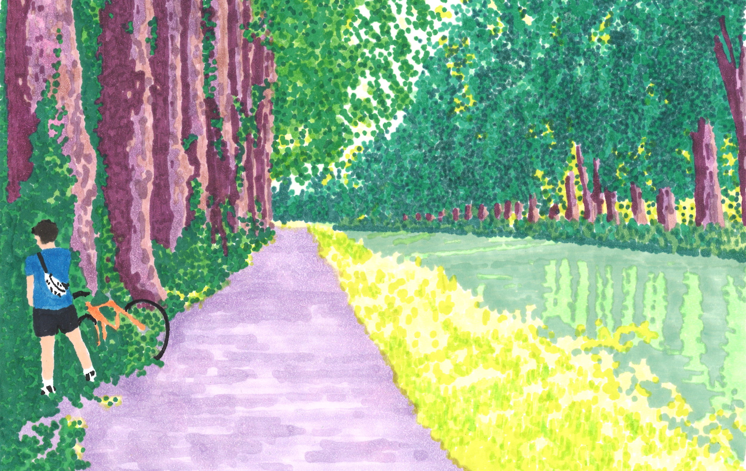
On vacation with Jeannie L #3
An artistic epic on bicycle Bordeaux - piste du canal latéral de la Garonne